Case Study
Harnessing Machine Learning to Count Whales from Space


Author



Professor Carola Bibiane Schönlieb
Keywords
artificial intelligence
image analysis
ecology
Overview
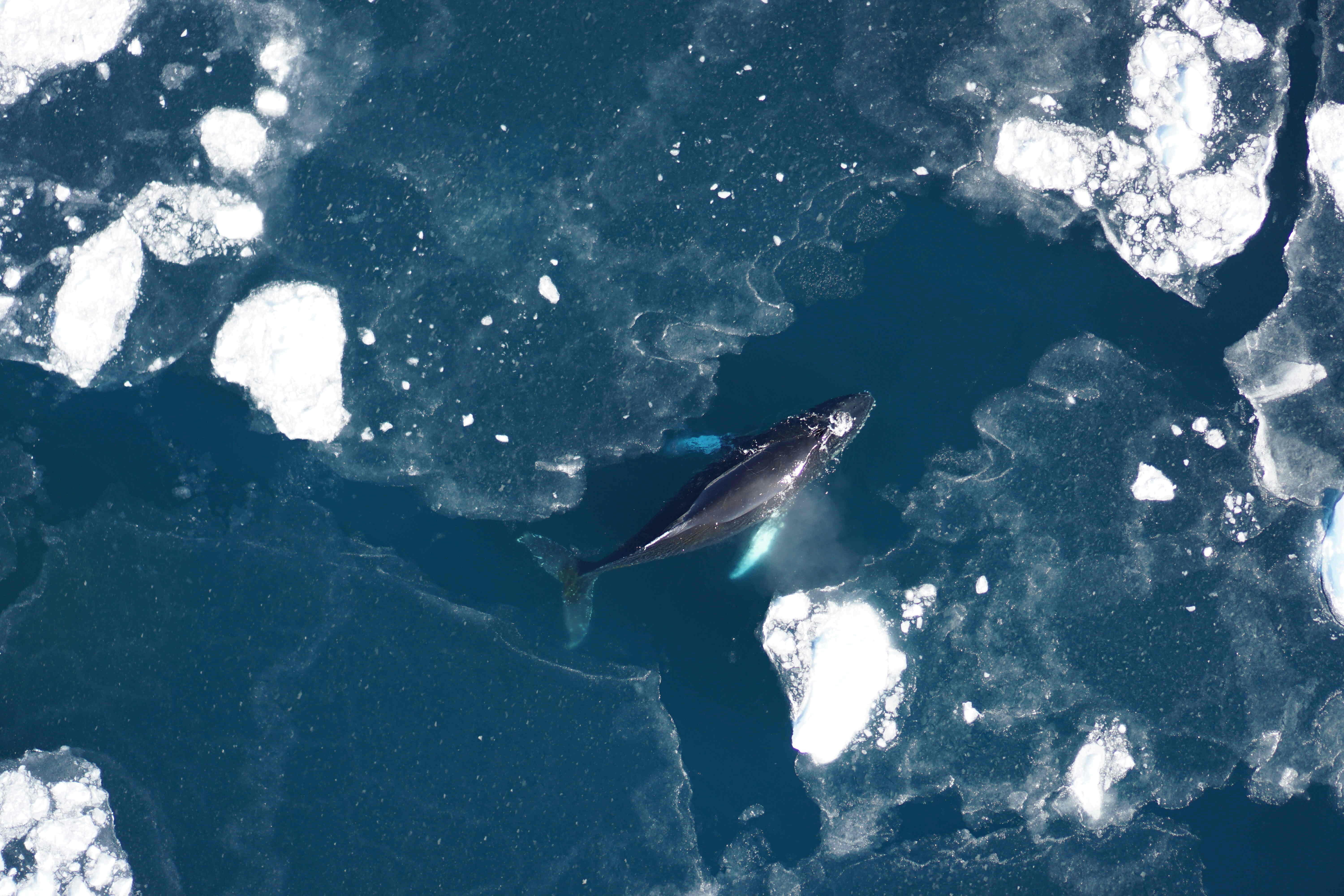
One such population being monitored are humpback whales. Although this species is recovering from historic commercial whaling, humpback whales continue to face a range of threats including ship strike and entanglement in fishing gear. Recent satellite technological advancements have produced imagery with spatial resolutions of up to 30cm, making it possible to identify individual animals and distinguishing features. However, with a massive dataset covering around 8500km2 of imagery, looking for whales approximately 15m in length is not entirely dissimilar to looking for a needle in a haystack!
The Project
Holly Houliston and CHIMiRA mathematician, Carola-Bibiane Schönlieb, are working as part of an interdisciplinary team across the University of Cambridge and the British Antarctic Survey, to develop robust, generalisable models to identify whales in satellite imagery.
Detecting small objects in variable imagery
Humpback whales are particularly interesting to study as they are migratory, wide ranging, and behaviourally diverse. Travelling thousands of kilometres each year, breeding and calving in tropical and temperate regions such as Hawaii, and migrating to high-latitude regions, such as the Antarctic, to feed in the highly productive waters. From an image analysis perspective, this creates substantial complexity, due to variability in water colour and turbidity, as well as the presence of confounding factors, such as ice, whitecaps, and boats. The whales themselves also appear very different depending on their behaviour, for example a feeding whale looks quite different from one which is travelling, resting, or breaching above the water surface.
Why the numbers matter
Accurately counting the number of whales in satellite imagery matters is important these estimates can be used to inform conservation management, including population assessments, protected area planning, and vessel management measures. Given the quantity of data collected, the manual annotation of humpback whales in raw imagery is time-consuming, costly, and subject to human variability. The team is therefore developing semi-automated machine learning methods, to identify these small objects in complex and variable images. These methods first narrow down the initial search by localising and counting potential whales, before predictions are verified through expert human review.
To scale the methods developed, the team’s long-term aim is to ensure that the models are generalisable across environmental conditions, geographical locations, and the full breadth of whale behaviours. Ultimately, this project aims to improve the scalability of satellite-based methods, improving whale monitoring across remote and rapidly changing marine environments.
Credit: Duke Marine Robotics and Remote Sensing Lab.
Acknowledgements
Keep Reading
View all case studiesSee maths in action








Connect with us
Explore how CHIMiRA can transform your research or business challenges through mathematical innovation. We are an open house for ideas and consider projects from any academic discipline, business, industry or the third sector.
Contact us